The Fes el-Bali medina is the walled old city of Fes, born from two Idrisid foundations in 789 and 809, listed as a UNESCO World Heritage Site since 1981 and explored almost entirely on foot: roughly 2.2 km² of lanes, souks, mosques and courtyard houses where tens of thousands of people still live. It is not a stage set but an inhabited district, with its mule drivers, Quranic schools, communal bread ovens and workshops that open before the souvenir shops do.
This page does not describe every monument: the series gives each one its own article. It is about the city itself, how it took shape, how it works and how to move around it without wearing yourself out or following the first “guide” who shows up. For the big picture of your stay, our complete guide to things to do in Fes is the place to start; here we stay inside the walls. (You will also see the city spelled Fez, the older English form.)
At a glance
- Fes el-Bali (“Old Fes”) grew out of two towns: Madinat Fas, founded by Idris I in 789 on the right bank of the river, and al-Aliya, founded by Idris II in 809 on the opposite bank.
- The two towns were merged by the Almoravid ruler Yusuf ibn Tashfin around 1069-1070; the present walls are mostly Almohad and were completed in 1204.
- The Medina of Fez, which includes Fes el-Bali and Fes el-Jdid, has been on UNESCO’s World Heritage List since 1981.
- No car can cross it: people walk, and goods travel by donkey, mule or handcart. It is often described as the largest contiguous car-free urban area in the world, a claim best read as an estimate.
- Two main streets, Tala’a Kebira and Tala’a Seghira, run downhill from the Bab Bou Jeloud area towards the Qarawiyyin Mosque and serve as your guiding thread.
- Entry to the medina is free and open; only some monuments (madrasas, museums, restored funduqs) charge admission.
- Only guides holding a licence and badge issued by the tourism authorities (Law 05-12) may accompany visitors for payment.
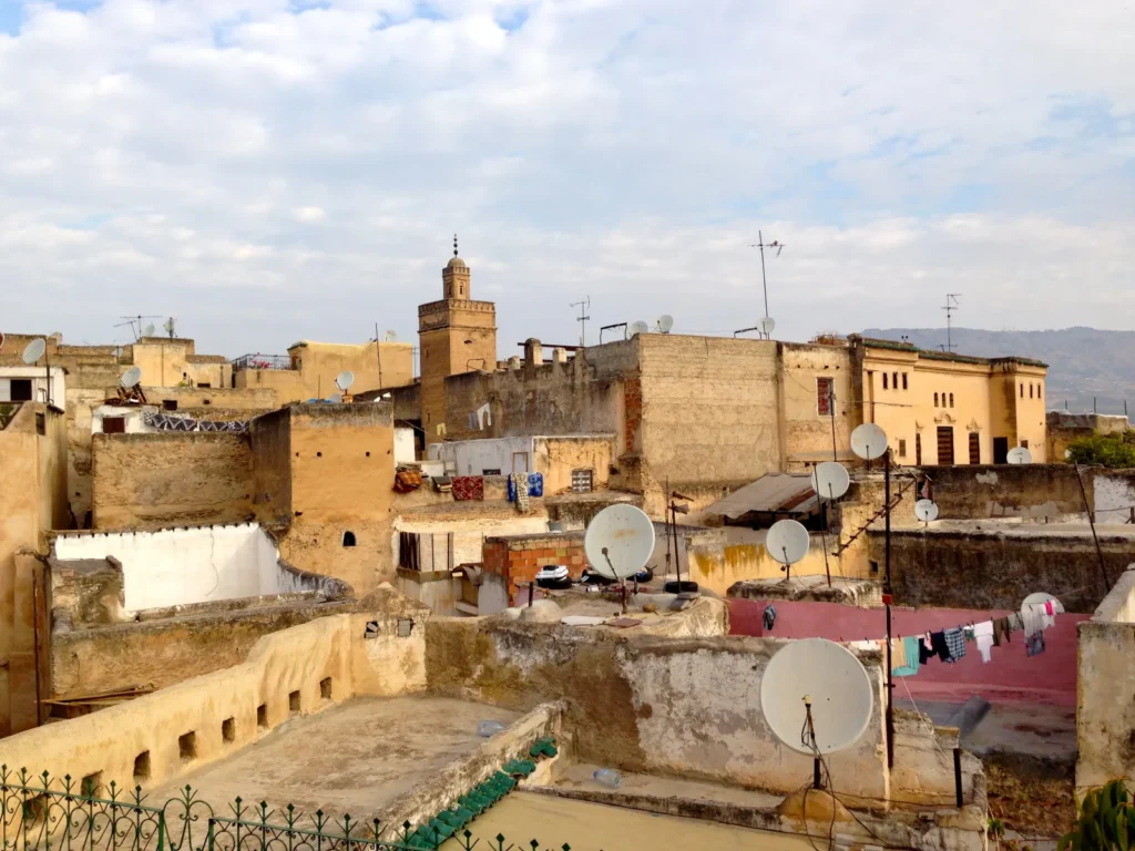
History of the Fes el-Bali medina: two towns that became one
You often read that Fes was “founded in 808”. That is only half right. Historians distinguish two successive foundations, one on each side of the river running along the valley floor. This duality is not a scholar’s footnote: you still feel it when you walk, because the line between the two banks separates two atmospheres, two slopes and two rhythms.
789 and 809: the two Idrisid foundations
In 789, Idris I, a descendant of the Prophet who had taken refuge in the Maghreb after the conflicts tearing the East apart, founded a first settlement, Madinat Fas, on the right bank of the river. Twenty years later, in 809, his son Idris II established a second town, al-Aliya, on the opposite bank and moved his capital there from Walili, ancient Volubilis. For more than a century and a half these were two separate cities, each with its own walls, its own great mosque and its own people, facing each other across the river.
Their settlers explain the names they still carry. In the 9th century the east bank took in families from al-Andalus, especially from Cordoba, and became Adwat al-Andalus, the “bank of the Andalusians”. The west bank received families from Kairouan, in present-day Tunisia: this is Adwat al-Qarawiyyin, the “bank of the Kairouanese”. Two mosques founded a few years apart embody the division. The Qarawiyyin was founded in 857 or 859, depending on the source, by Fatima al-Fihri, originally from Kairouan; the Mosque of the Andalusians was built in 859-860 and tradition attributes it to her sister Maryam.
1069-1070: Almoravid unification, then Almohad walls
The turning point came with the Almoravid conquest. Around 1069-1070, Yusuf ibn Tashfin had the walls dividing the two towns torn down and a new common enclosure raised around both banks. Fes became a single city, and the river, until then a border, became its central axis.
The Almohads, masters of Fes in the 12th century, rebuilt the ramparts. Caliph Yaqub al-Mansur began the reconstruction, which was completed in 1204 under his successor Muhammad al-Nasir. It is this line, not the Idrisid one, that still defines the perimeter of Fes el-Bali today. Several major gates, including Bab Mahrouk, Bab Guissa and Bab Ftouh, date essentially from this period. For the detailed story of each gate and tower, see our article on the gates and ramparts of Fes.
The Marinid golden age and the birth of Fes el-Jdid
In the 13th century the Marinids made Fes their capital. In 1276 Sultan Abu Yusuf Yaqub founded a brand-new administrative and military town to the west, Fes el-Jdid, “New Fes”, where the palace and garrison settled. The old city was then, by contrast, named Fes el-Bali. The paradox is that the old town had never been busier. Between 1271 and 1357 the Marinids built a series of madrasas there, the colleges that housed students attending the Qarawiyyin. UNESCO points out that the urban fabric and the main monuments of the medina (madrasas, funduqs, palaces, residences, mosques, fountains) date largely from this 13th- and 14th-century period, when Fes replaced Marrakesh as capital of the kingdom.
From the protectorate to World Heritage status
Later dynasties, the Wattasids, Saadians and Alaouites, changed the city only at the margins. At the end of the 16th century the Saadians added two forts on the hills, Borj Nord and Borj Sud, designed for artillery and aimed as much at the city as at outside threats. The Treaty of Fes of 1912, which established the French protectorate, mattered more. Rather than cutting boulevards through the medina, the colonial administration built a new town several kilometres away. The old city kept its shape but gradually lost its wealthy families and part of its functions. In 1913 the monumental Bab Bou Jeloud gate, blue-tiled on the outside and green on the inside, replaced a more modest entrance.
The Medina of Fez was inscribed on the World Heritage List in 1981 under criteria (ii) and (v). UNESCO sees it as an outstanding example of a medieval town created in the first centuries of the Islamisation of Morocco, representative of Moroccan urban culture from the 9th to the early 20th century. In 1989 the Agency for the De-densification and Rehabilitation of the Medina of Fez (ADER-Fès) was set up to run conservation programmes. Since then the work has been continuous: threatened houses propped up with timber beams, funduqs and madrasas restored, riverbanks redesigned.
| Date | Event | What you see today |
|---|---|---|
| 789 | Idris I founds Madinat Fas on the right bank | The future Andalusian Quarter |
| 809 | Idris II founds al-Aliya on the opposite bank and makes it his capital | The Qarawiyyin Quarter, commercial and religious heart |
| 857 or 859 | Fatima al-Fihri founds the Qarawiyyin Mosque | Mosque still in use |
| 859-860 | Mosque of the Andalusians built | Great portal on the east bank |
| Around 1069-1070 | Almoravids unite the two towns | A single medina linked by bridges |
| 1204 | Almohad ramparts completed | The present perimeter of Fes el-Bali |
| 1271-1357 | Marinid madrasas built | Bou Inania, Attarine and other colleges |
| 1276 | Fes el-Jdid founded | The old town takes the name Fes el-Bali |
| Late 16th century | Saadian forts of Borj Nord and Borj Sud | Viewpoints over the medina |
| 1912-1913 | Treaty of Fes, then the new Bab Bou Jeloud gate | New town kept apart; busiest entrance |
| 1981 | Medina of Fez inscribed as World Heritage | Protection and restoration programmes |
| 1989 | ADER-Fès created | Restorations, shoring, signposted routes |
How the Fes el-Bali medina works day to day
Car-free, really?
The line is everywhere: Fes el-Bali is supposedly “the largest car-free urban area in the world”. It comes mainly from a survey of car-free cities that describes it as the largest contiguous car-free area in terms of population, based on some 156,000 residents estimated in the early 2000s. Nobody has produced an official world ranking, and the population has changed since. So keep a simpler and fully verifiable fact in mind: you cannot drive across the medina. The only road that enters follows the river down to Place R’cif, and car parks spread out in front of a few gates. Beyond that, everything moves on foot.
In practice, gas bottles, sacks of cement, crates of vegetables and travellers’ suitcases all travel by donkey or mule, or in handcarts pushed through lanes some of which are no more than 60 centimetres wide. When you hear “balak!” behind you, flatten yourself against the wall: it is a loaded muleteer’s warning, and he will not slow down. A few motorbikes use the rare passable streets, but steps and slopes keep them out of most lanes. Cycling makes little sense here.
Two banks and a patchwork of neighbourhoods
The Oued Bou Khrareb, a branch of the Oued Fes, runs through the medina and historically divides the two banks. To the west, the Qarawiyyin bank, the larger one, holds the main market streets, the Qarawiyyin Mosque and the Zawiya of Moulay Idris II; most riads and visited monuments are here. To the east, the Andalusian bank is more residential, steeper and far less visited; the Mosque of the Andalusians and its monumental portal are its landmark. Between the two, the riverbed is now largely covered by the road that runs down to Place R’cif.
In the early 20th century the historian Roger Le Tourneau recorded eighteen historic neighbourhoods in Fes el-Bali. Each neighbourhood (houma) had, and often still has, its own local facilities: a mosque, a fountain, a communal oven where families bring their bread dough, a hammam and a Quranic school (msid). That is why the medina works like a cluster of villages: you can live for years in your derb without needing to cross the city. For visitors this has a useful consequence: if you see a bread oven and a fountain, you are deep in a residential area, not on a through route, and it is time to turn back if you are looking for the souks.
Derb, funduq, kissaria: words that help
A derb is a lane, often a dead end, serving a cluster of houses; its gate used to be shut at night, and you will still see some of the door leaves. A funduq is a former caravanserai: a building around a central courtyard where merchants slept upstairs and stored goods on the ground floor; many now house workshops or cooperatives. A kissaria is a covered market for valuable goods, textiles in particular. A souika is a small neighbourhood market. A dar is a courtyard house; a riad, strictly speaking, is a house built around an inner garden, although the word now means any guesthouse.
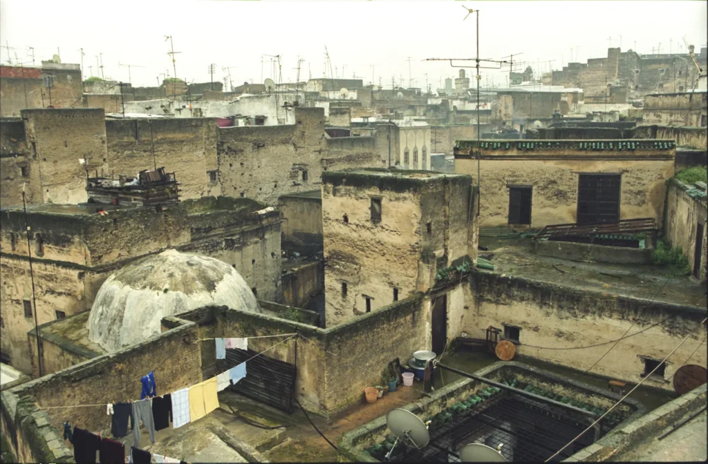
This architecture looks inward. Street façades are bare, with few openings; an ordinary door may lead to a colonnaded courtyard covered in zellige tilework and carved stucco. That is why the medina looks austere at first sight: its wealth is behind the walls. Two things often surprise visitors: the sabats, covered passages where a house bridges the lane, and timber beams wedged across some streets between two façades. These props are not a danger; they are there to stop old walls from spreading and are part of the consolidation programmes.
Water, the invisible infrastructure
Fes owes its existence to abundant water. The historic network distributed river water through channels, kept separate from those that carried waste water away, to houses, public fountains, hammams, mosque ablution rooms and workshops. Near Bab Bou Jeloud, a distribution structure with three arches regulated the supply between neighbourhoods according to set priorities. You will pass zellige neighbourhood fountains everywhere, some dry, others still used by residents.
The river itself long disappeared from view, covered with slabs and then with a road between Bab Jdid and Place R’cif. From the late 2000s a major rehabilitation project led by architect Aziza Chaouni cleaned up sections of the river, created pedestrian paths along the banks and redesigned Place R’cif. Walking down to R’cif you can see the difference: the square has become a breathing space in an extremely dense city.
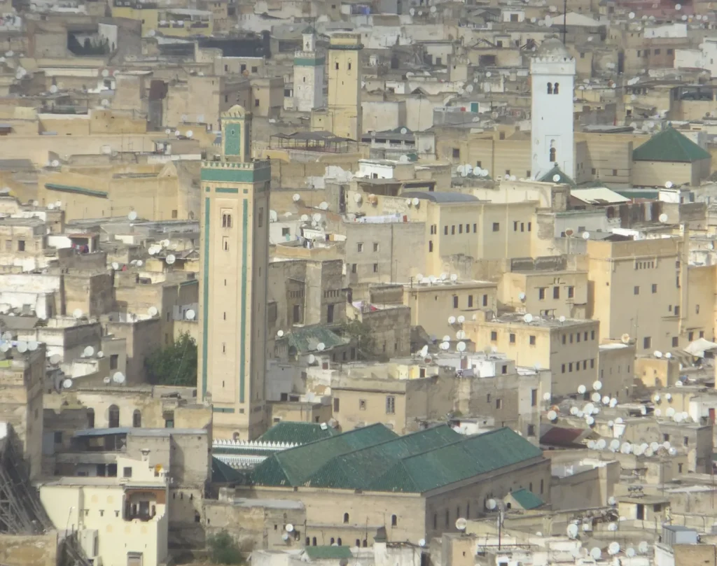
Finding your way in the Fes el-Bali medina
You will get lost. Everyone gets lost in Fes el-Bali, including Fassis who barely know a neighbourhood far from their own. The aim is not to avoid getting lost but to find your bearings again within a few minutes, without panicking and without following whoever offers to “show you”. Four tools are enough.
Tala’a Kebira and Tala’a Seghira, the two spines
Tala’a Kebira, the “great ascent”, is the city’s main market street. It starts near Bab Bou Jeloud and Bab Mahrouk in the west and runs downhill eastwards to the Attarine Madrasa, next to the Qarawiyyin Mosque. It is not straight, because it follows the gentlest slope of the valley, but it is one of the widest and most continuous streets in the medina. Along it you pass the Bou Inania Madrasa and, opposite, Dar al-Magana, the house of the Marinid water clock, then the Chrabliyine Mosque, whose minaret is among the most elegant in the city, before entering Souk al-Attarine, the old spice and perfume market.
Tala’a Seghira, the “small ascent”, also starts at Bab Bou Jeloud and runs roughly parallel, a little further south, before rejoining Tala’a Kebira in the Ain Allou area, between the Chrabliyine Mosque and Place Nejjarine. Quieter in the morning, it makes an excellent return route. Remember that the two streets form a kind of spindle: if you leave one without straying too far, you almost always end up back on the other.
The slope is a better compass than your phone
The medina fills a valley. Bab Bou Jeloud is high up; the Qarawiyyin and Place Seffarine are at the bottom, near the river. The rule is simple: going down takes you towards the old core and the great monuments; going up brings you back to Bab Bou Jeloud and the western gates. Lost and tired at the end of the day? Choose the uphill lane and follow residents carrying shopping bags: they are heading for a gate or a taxi rank.
Fixed landmarks to memorise
- Bab Bou Jeloud, its square and cafés: the city’s meeting point, at the top of the medina. Our article on Bab Bou Jeloud, the Blue Gate covers its surroundings.
- Ain Allou and Place Nejjarine: where the two Tala’as meet, with the monumental fountain and the former funduq that houses the woodwork museum.
- The Zawiya of Moulay Idris II and Souk al-Attarine: the religious and commercial centre, where crowds are densest.
- Place Seffarine and the hammering of the coppersmiths: just behind the Qarawiyyin, the low point of the west bank.
- Place R’cif: the only spot in the heart of the medina reached by taxis; your emergency exit.
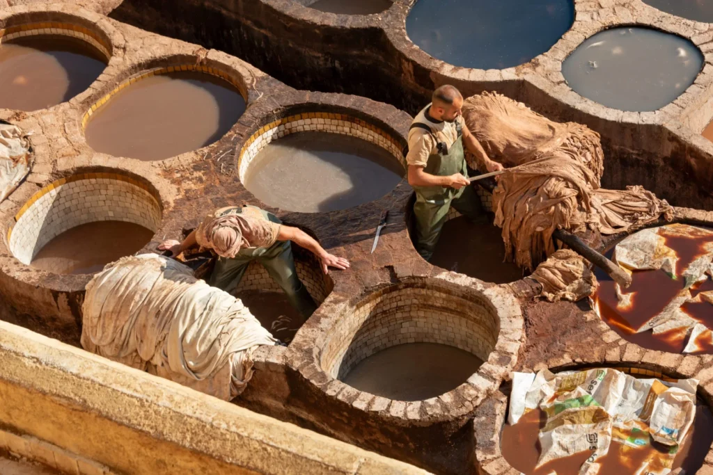
- The Chouara tanneries, north of Seffarine: you smell them before you see them, which makes them a landmark in their own right.
The signposted tourist circuits
Themed circuits do exist. They were designed by ADER-Fès, which published a guide to thematic tourist circuits with a map of the medina in 2005. On the ground, the routes are marked by small coloured plaques fixed at junctions, each circuit with its own colour, and information panels with maps stand near the main sites. The themes include monuments and souks, crafts, the ramparts and Fes el-Jdid; the exact match between colours and themes is shown on the panels and on the map, so check it before setting off. Two caveats: some plaques are faded or missing, and some shopkeepers have hung their own arrows, which mostly lead to their shop. Use the circuits as a guiding thread, not a guarantee, and check the state of the signs with your accommodation.
GPS and offline maps: useful, within limits
Download an offline map before you arrive. The GPS dot drifts in narrow, covered lanes, sometimes by several dozen metres, and some dead ends appear on no map; but the screen is enough to tell you which side Tala’a Kebira or the nearest gate is on. Save your riad’s location before going out and photograph its door and the street sign, because many guesthouses have only a small plaque. To ask the way, speak to a shopkeeper sitting in his shop rather than to a young man who approaches you: the former has no interest in taking you anywhere else.
Which gate to use to enter the Fes el-Bali medina
Fes el-Bali has about a dozen entrances, counting both monumental gates and simple passages. In practice five or six are enough for visitors. The right choice depends on where your riad is and what you want to see first. Many travellers enter through Bab Bou Jeloud out of habit, when Place R’cif would drop them two minutes from their guesthouse.
| Entrance | Location | Best for | Good to know |
|---|---|---|---|
| Bab Bou Jeloud | West, top of the medina, towards Fes el-Jdid | First visit, start of both Tala’as | 1913 gate, the busiest; many touts |
| Bab Mahrouk | West, slightly north of Bab Bou Jeloud | Reaching the top of Tala’a Kebira | Almohad gate from the early 13th century |
| Bab Chorfa | West, near Bab Mahrouk | Access through the Kasbah An-Nouar | Present form dates from the Alaouite era |
| Bab Guissa | North | Riads in the north of the medina, climb to Borj Nord | Almohad gate; taxis nearby |
| Place R’cif | Centre, by the river | Straight to the heart: Seffarine, Qarawiyyin, Andalusian bank | The only central point served by taxis |
| Bab Ftouh | South-east, Andalusian bank | Andalusian Quarter, large cemetery nearby | Almohad gate; few tourists |
Three ways to explore the medina in half a day
The main axis, from Bab Bou Jeloud to Place Seffarine
- Enter through Bab Bou Jeloud and take Tala’a Kebira, the street heading downhill on the left of the gate when seen from inside.
- Stop at the Bou Inania Madrasa, then look up at the façade of Dar al-Magana, directly opposite.
- Keep going down to the Chrabliyine Mosque and the Ain Allou junction; make the detour to Place Nejjarine.
- Cross Souk al-Attarine along the edges of the Zawiya of Moulay Idris II.
- Reach the Attarine Madrasa and the doors of the Qarawiyyin, then Place Seffarine.
- Leave from Place R’cif by taxi, or climb back up via Tala’a Seghira if your legs allow.
Allow three to four hours with two indoor visits. The descent is effortless; the full climb back easily takes forty minutes of steady walking.
The Andalusian bank, to see the lived-in city
From Place R’cif, cross the river and walk up towards the Mosque of the Andalusians. There are few souvenir shops here: grocers, ovens, workshops, children coming out of school. The mosque’s great portal is viewed from the street. Continue towards Bab Ftouh and its vast cemetery, then return by taxi. Two to three hours is enough. This is the area where an official guide adds the most, because landmarks are scarce and the lanes look alike.
The viewpoints, to grasp the layout at a glance
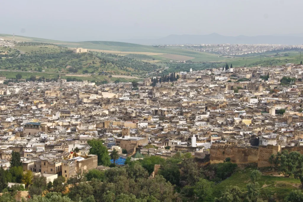
In the late afternoon, take a taxi up to Borj Nord and the Marinid Tombs. From there the whole medina spreads out in its bowl: the Qarawiyyin bank opposite, the green roof of the Qarawiyyin, the gap of the river. In ten minutes you understand what three hours in the lanes cannot show. The Borj Sud viewpoint, on the other slope, gives the opposite view, with the R’cif Mosque in the foreground. Walk back down through Bab Guissa before dark.
Fake guides, touts and safety in the Fes el-Bali medina
For a long time Fes had a reputation as the most tiring Moroccan city for fake guides. The pressure has eased but still exists, especially around Bab Bou Jeloud, at the top of Tala’a Kebira and near the tanneries. The scripts repeat themselves: “this street is closed”, “the tanneries are this way”, “today is the last day of the Berber market”, or simply a young man walking beside you, commenting, then asking for money. The most effective answer is short, polite and keeps moving: “no thank you, I already have a guide” or “I’m going to my riad”. Avoid justifying yourself, pulling out your map in the middle of an insistent group or following someone “just to see”.
An official guide, on the other hand, genuinely transforms a first day. In Morocco the profession is regulated by Law 05-12: the licence, professional card and badge are issued by the tourism authorities and are strictly personal. Ask to see the badge, book through your riad or the regional guides’ association, and agree in advance on the duration, programme, price and number of shop stops, or none at all. All the common scams and how to deal with them are covered in our feature on fake guides and scams in Fes.
As for safety, the medina is not a danger zone, but it changes character at night. Once the shops close, the lanes of residential neighbourhoods empty and some are poorly lit. Head back before it gets late, or ask your riad to meet you at a gate. In the crush of Souk al-Attarine, carry your bag in front of you and your phone in a closed pocket. In an emergency the police number is 19; officers are present around the main gates.
Souk opening hours and the rhythm of the day
The medina runs on a timetable, and knowing it saves you a day. Craftsmen and food traders start early: fruit, vegetable and meat markets are at their best in the morning. Shops aimed at visitors tend to open between 9 and 10 am. Midday slows down, sometimes with a lunch break, and late afternoon is the liveliest time, when residents do their shopping. Most shops close between 7 and 8 pm, earlier in winter, later in summer, and hours shift markedly during Ramadan, with night-time activity after the fast is broken.
Friday is different. Around the main midday prayer many shops close, and some do not reopen in the afternoon. It is not the day for your big shopping session, but it is a good day for quiet lanes and viewpoints. These hours are observed patterns, not official rules: they vary by trade and season. To know where to buy what, our article on the souks of Fes reviews the specialised markets trade by trade.
Visiting the Fes el-Bali medina: practical information
| Topic | What to know |
|---|---|
| From the airport | Fes-Saïss Airport is about fifteen kilometres south of the city; taxi to a medina gate, roughly 20 to 30 minutes depending on traffic |
| From the station | ONCF railway station in the new town; petit taxi to Bab Bou Jeloud, Bab Guissa or Place R’cif |
| Hours | The medina is a district open at all times; shops generally from 9-10 am to 7-8 pm; monuments keep their own hours |
| Price | Free entry; madrasas, museums and some funduqs charge admission, with prices posted at the entrance |
| Dress | Covered shoulders and knees recommended; closed shoes with non-slip soles, as the paving is slippery |
| Time needed | At least one full day; two or three days for both banks and the viewpoints |
| Best time | Spring and autumn; early morning for the lanes, late afternoon for the bustle; avoid Friday midday for shopping |
| Places of worship | Mosques and zawiya reserved for Muslims; other visitors look from the doorway without crossing the threshold |
Arriving with suitcases takes a little planning, since no taxi can drop you at your riad’s door. The simplest solution is to arrange a meeting point with your accommodation at a gate or at Place R’cif: a staff member comes to fetch you, often with a porter and a handcart, who will expect a tip. If you are flying in, our page on Fes-Saïss Airport sets out the transport options into the city. Travel light: a backpack or a suitcase with sturdy wheels copes better with cobbles and steps than a large hard-shell case.
For photos, the rule is the same everywhere in Morocco but matters more here, where you are photographing people in their home streets: ask before framing someone, and accept a refusal without insisting. Craftsmen at work often agree if you have bought something or taken time to talk. Carry small notes and coins for tips, fresh juices and small purchases, because traders struggle to give change for large notes.
Around the medina
- Fes el-Jdid and the mellah: the Marinid town of 1276, with the former Jewish quarter and the great gates of the royal palace on Place des Alaouites, reachable on foot from Bab Bou Jeloud along the Jnan Sbil garden.
- Jnan Sbil garden: a public park between the two towns, the ideal shady break after the medina.
- Borj Nord and the Marinid Tombs: a complete panorama over Fes el-Bali, especially at sunset.
- Borj Sud: the opposite viewpoint, above the Andalusian bank and Place R’cif.
- The new town: avenues, cafés and modern restaurants, ONCF station; useful for a change of air or practical errands.
Mistakes that spoil a first visit
- Trying to see everything in one morning: Fes el-Bali reveals itself over several short outings, not a marathon.
- Arriving at night without a meeting arranged with the riad: the surest way to end up escorted by a stranger who will demand payment.
- Following someone who claims a street is closed: check your map or ask a shopkeeper.
- Wearing flimsy sandals: the cobbles are uneven, sometimes wet, and the slopes steep.
- Photographing people without asking, or walking into a mosque because the door is open.
- Bargaining without having set your own price first: decide what an object is worth to you before asking the price.
FAQ about the Fes el-Bali medina
Can you visit the Fes el-Bali medina without a guide?
Yes. With an offline map, the two Tala’as as axes and the slope as a compass, an independent visitor manages very well on the Qarawiyyin bank. An official guide is still worthwhile for a first half-day, for the Andalusian bank and for understanding what lies behind the façades.
Do you have to pay to enter the medina?
No. Fes el-Bali is an inhabited district, open to all and free. You only pay to enter certain monuments, such as madrasas or museums, whose prices are posted on site and may change.
How much time should you allow?
A full day lets you walk the main axis and go inside two or three monuments. Two to three days are better to add the Andalusian bank, the viewpoints and unplanned moments, which are often the best.
What is the difference between Fes el-Bali and Fes el-Jdid?
Fes el-Bali is the old city, born from the Idrisid foundations of 789 and 809. Fes el-Jdid is the administrative town founded by the Marinids in 1276, with the royal palace and the mellah. Together they form the Medina of Fez inscribed by UNESCO in 1981.
Is the medina safe in the evening?
The main streets stay busy until the shops close. After that, residential lanes empty and are sometimes poorly lit: it is better to head back early or have riad staff walk you home, especially on your first evenings.
Can non-Muslims enter the mosques?
No, the mosques and the Zawiya of Moulay Idris II are reserved for Muslims. You can look from the doorway, discreetly and without crossing the threshold. The madrasas, however, are open to visitors. Access rules can change during restoration work, so ask on site.
How do you reach your riad with luggage?
Arrange to meet the riad at the nearest gate or at Place R’cif. A staff member guides you on foot, often with a porter and his handcart. Plan a tip and avoid arriving alone at night without such an arrangement.
Is it really the largest car-free area in the world?
It is a common claim, based on an estimate of its area and population in the early 2000s, with no official ranking. What is certain: no car can cross Fes el-Bali, and virtually the whole city is explored on foot.
Summary
Fes el-Bali is not a collection of monuments linked by lanes; it is a whole city that still works according to its medieval logic: two banks born from two foundations, self-contained neighbourhoods, a river that long drove the economy, and traffic that is entirely on foot. To get to grips with it, keep three keys in mind: the two Tala’as as axes, the slope as a compass, Place R’cif as your exit. Politely turn down unsolicited companions, hire a badged guide if you want to understand in depth, and leave yourself at least one morning with no plan. That is often when the medina shows itself best.
Official sources
- UNESCO World Heritage Centre: Medina of Fez
- Moroccan Ministry of Tourism, Handicrafts and Social and Solidarity Economy: tourist guides
- Moroccan National Tourist Office (Visit Morocco): Medina of Fez
- Fes Regional Tourism Council
- Airports of Morocco (ONDA)
- Moroccan National Railways (ONCF)
Informational article updated in September 2026. Prices, opening hours and access conditions for monuments and shops may change: check them on site or with the official bodies before your visit.
Photo credits
Images: featured image « File:Fes el Bali(js).jpg » — Jerzystrzelecki (CC BY 3.0); « File:Fes Morocco Medina rooftops Sept 2014 – 1 (15922382065).jpg » — Andrew Nash (CC BY-SA 2.0); « File:View of Rcif Mosque and Qarawiyyin minarets.jpg » — Casual Builder (CC BY-SA 4.0), via Wikimedia Commons.